Military Bases Menu:
• UK Military Bases
MoD Boscombe Down Information:
• History
• Current Aircraft
• Satellite View
• Trackers
• Scanner Frequencies
Location:
• Google Road Map
Travel Info:
• AA Route Finder
• National Rail
• National Express
Satnav Postcode:
• SP4 0JF
Weather Forecast:
• BBC UK Weather
• BBC Local Weather
Photographs:
• Photographs
Message Board:
• Forum
Trackers:
• Military Aircraft Tracker
• UK Military Aircraft Tracker
• Historic UK Military Aircraft Tracker
• Flight Radar 24
• Plane Finder
• ADS-B Exchange
• Military Ship Tracker
Related Links:
• MoD Boscombe Down Website
• MoD Boscombe Down Wiki
• Pb-photos Aviation Maps
Runway(s) :
• 10,538ft (05/23)
• 6,280ft (17/35)
RAF Bases
• RAF Benson
• RAF Brize Norton
• RAF Coningsby
• RAF Cranwell
• RAF Leeming
• RAF Linton-on-Ouse
• RAF Lossiemouth
• RAF Marham
• RAF Northolt
• RAF Odiham
• RAF Scampton
• RAF Shawbury
• RAF Valley
• RAF Waddington
• RAF Wittering
RAF Bases operated by USAF
• RAF Fairford
• RAF Lakenheath
• RAF Mildenhall
Fleet Air Arm Bases
• RNAS Culdrose
• RNAS Yeovilton
Army Air Corps
• Aldergrove
• Dishforth
• Middle Wallop
• Wattisham
MoD
• Boscombe Down
Relevant Links:
• UK Military Bases Photographs
• Boscombe Down Aviation Collection
• Boscombe Down Incident
• Speed of Sound
• DSLR cameras & lens
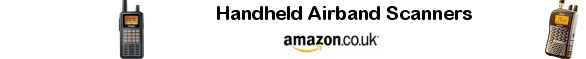
• Airband Scanners
• Airport Scanner Frequencies
• RAF / Airshow Scanner Frequencies
• Live aviation
MoD Boscombe Down is an aircraft testing site which is located at Amesbury in Wiltshire, and is run and managed by QinetiQ.
Boscombe Down evaluates British Armed Forces aircraft and is home to the Rotary Wing Test and Evaluation Squadron, Heavy Aircraft Test Squadron, Handling Squadron, and the Empire Test Pilots School (ETPS).
Approach - 126.700, 340.250, 130.000 Director - 362.050, 130.000 Zone - 126.700, 256.500 Radar - 292.275 PAR - 373.150, 130.000 Tower - 369.425, 130.750 Ground - 130.750, 374.450 OPS - 376.725 ATIS - 232.850 |
| Add Your Photographs |
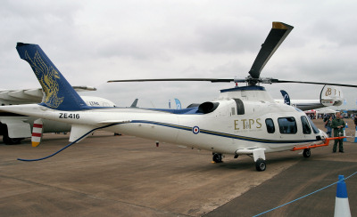 ETPS Agusta Westland AW109.
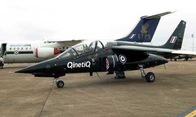
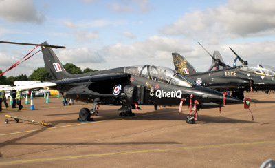 ETPS Alpha Jet & Hawk.