Military Bases Menu:
• UK Military Bases
JHC FS Aldergrove Information:
• History
• Current Aircraft
• Satellite View
• Trackers
• Scanner Frequencies
Location:
• Google Road Map
Travel Info:
• AA Route Finder
• National Rail
• National Express
Satnav Postcode:
• BT29 4BP
Weather Forecast:
• BBC UK Weather
• BBC Local Weather
Photographs:
• Photographs
Message Board:
• Forum
Trackers:
• Military Aircraft Tracker
• UK Military Aircraft Tracker
• Historic UK Military Aircraft Tracker
• Flight Radar 24
• Plane Finder
• ADS-B Exchange
• Military Ship Tracker
Related Links:
• 5 Regt AAC Website
• JHFS Aldergrove Wiki
Runway(s) :
• 9,121ft (07/25)
• 6,204ft (17/35)
RAF Bases
• RAF Benson
• RAF Brize Norton
• RAF Coningsby
• RAF Cranwell
• RAF Leeming
• RAF Linton-on-Ouse
• RAF Lossiemouth
• RAF Marham
• RAF Northolt
• RAF Odiham
• RAF Scampton
• RAF Shawbury
• RAF Valley
• RAF Waddington
• RAF Wittering
RAF Bases operated by USAF
• RAF Fairford
• RAF Lakenheath
• RAF Mildenhall
Fleet Air Arm Bases
• RNAS Culdrose
• RNAS Yeovilton
Army Air Corps
• Aldergrove
• Dishforth
• Middle Wallop
• Wattisham
MoD
• Boscombe Down
Relevant Links:
• UK Military Bases Photographs
• Speed of Sound
• DSLR cameras & lens
• Airband Scanners
• Airport Scanner Frequencies
• RAF / Airshow Scanner Frequencies
• Live aviation
Joint Helicopter Command Flying Station (JHC FS) Aldergrove is located south of Antrim in Northern Ireland. The flying station adjoins Belfast International Airport and shares the runways but has its own separate facilities and helipad.
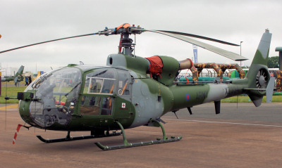
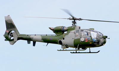
JHC FS Aldergrove is currently home to 665 Squadron (AAC/JHC), 5 Regiment, with their Westland Gazelle AH.1s. The Northern Ireland Universities Air Squadron & No.13 Air Experience Flight RAF operate the Grob Tutor T1 and the civilian Police Service of Northern Ireland Air Support Unit operates the Eurocopter EC135T2 & EC145 helicopters.
Approach - 128.500, 278.350 Radar - 120.900 Tower - 118.300 Ground - 121.750 ATIS - 128.200 |
| Add Your Photographs |
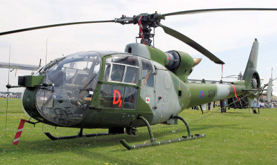 Gazelle AH.1.
 Gazelle AH.1.
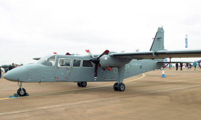 Britten-Norman Defender.
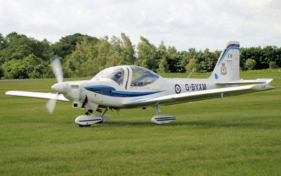 Grob Tutor T1.