Military Bases Menu:
• UK Military Bases
RNAS Culdrose Information:
• History
• Current Aircraft
• Satellite View
• Trackers
• Scanner Frequencies
Location:
• Google Road Map
Travel Info:
• AA Route Finder
• National Rail
• National Express
Satnav Postcode:
• TR12 7RH
Weather Forecast:
• BBC UK Weather
• BBC Local Weather
Photographs:
• Photographs
Message Board:
• Forum
Trackers:
• Military Aircraft Tracker
• UK Military Aircraft Tracker
• Historic UK Military Aircraft Tracker
• Flight Radar 24
• Plane Finder
• ADS-B Exchange
• Military Ship Tracker
Related Links:
• RNAS Culdrose Website
• Facebook Page
• Twitter Page
• RNAS Culdrose Wiki
• Pb-photos Aviation Maps
Runway(s) :
• 3,428ft (06/24)
• 6,001ft (11/29)
• 3,461ft (18/36)
RAF Bases
• RAF Benson
• RAF Brize Norton
• RAF Coningsby
• RAF Cranwell
• RAF Leeming
• RAF Linton-on-Ouse
• RAF Lossiemouth
• RAF Marham
• RAF Northolt
• RAF Odiham
• RAF Scampton
• RAF Shawbury
• RAF Valley
• RAF Waddington
• RAF Wittering
RAF Bases operated by USAF
• RAF Fairford
• RAF Lakenheath
• RAF Mildenhall
Fleet Air Arm Bases
• RNAS Culdrose
• RNAS Yeovilton
Army Air Corps
• Aldergrove
• Dishforth
• Middle Wallop
• Wattisham
MoD
• Boscombe Down
Relevant Links:
• UK Military Bases Photographs
• Speed of Sound
• DSLR cameras & lens
• Airband Scanners
• Airport Scanner Frequencies
• RAF / Airshow Scanner Frequencies
• Live aviation
• Air Show Calendar
• Culdrose Airshow
RNAS Culdrose (also known as HMS Seahawk) is located near Helston on the Lizard Peninsula of Cornwall, and is one of the largest helicopter bases in Europe.
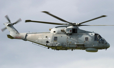
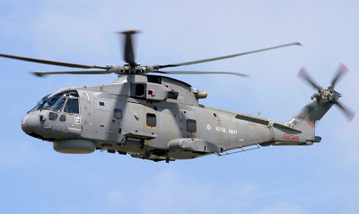
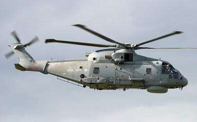
Culdrose is home to Royal Navy Merlin helicopters which are deployed on Royal Navy vessels.
750 Naval Air Squadron provides Basic Observer Training, operating the Beechcraft Avenger T1 and 700X Naval Air Squadron operates Unmanned Aerial Vehicles such as the ScanEagle UAV.
Approach - 282.575, 134.050 Radar - 279.700, 375.700 Director - 231.775, *123.300 PAR - 336.300, 336.525, *123.300 Tower - 370.650, *122.100 Ground - 241.925 ATIS - 278.900 *= NATO Common Frequency |
| Add Your Photographs |
 Merlin HM.2.
 Merlin HM.2.
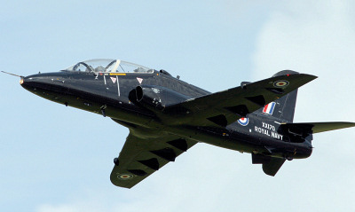 Hawk T.1.
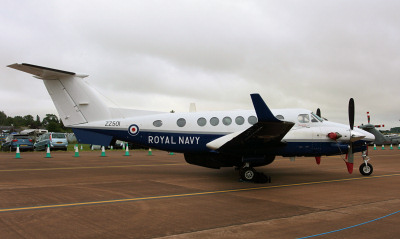 Avenger T.1.
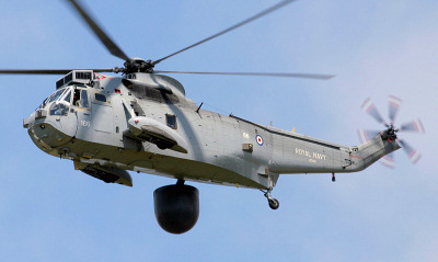 Sea King ASaC.7.