Military Bases Menu:
• UK Military Bases
RAF Coningsby Information:
• History
• Current Aircraft
• Satellite View
• Trackers
• Scanner Frequencies
Location:
• Google Road Map
Travel Info:
• AA Route Finder
• National Rail
• National Express
Satnav Postcode:
• LN4 4SY
Weather Forecast:
• BBC UK Weather
• BBC Local Weather
Photographs:
• Photographs
Message Board:
• Forum
Trackers:
• Military Aircraft Tracker
• UK Military Aircraft Tracker
• Historic UK Military Aircraft Tracker
• Flight Radar 24
• Plane Finder
• ADS-B Exchange
• Military Ship Tracker
Related Links:
• RAF Coningsby Station Website
• Facebook Page
• Twitter Page
• RAF Coningsby Spotters Group
• RAF Coningsby Wiki
• Pb-photos Aviation Maps
Runway(s) :
• 9,003ft (07/25)
RAF Bases
• RAF Benson
• RAF Brize Norton
• RAF Coningsby
• RAF Cranwell
• RAF Leeming
• RAF Linton-on-Ouse
• RAF Lossiemouth
• RAF Marham
• RAF Northolt
• RAF Odiham
• RAF Scampton
• RAF Shawbury
• RAF Valley
• RAF Waddington
• RAF Wittering
RAF Bases operated by USAF
• RAF Fairford
• RAF Lakenheath
• RAF Mildenhall
Fleet Air Arm Bases
• RNAS Culdrose
• RNAS Yeovilton
Army Air Corps
• Aldergrove
• Dishforth
• Middle Wallop
• Wattisham
MoD
• Boscombe Down
Relevant Links:
• Battle of Britain Memorial Flight Schedule
• RAF Typhoon Display Schedule
• UK Military Bases Photographs
• Speed of Sound
• DSLR cameras & lens
• Airband Scanners
• Airport Scanner Frequencies
• RAF / Airshow Scanner Frequencies
• Live aviation
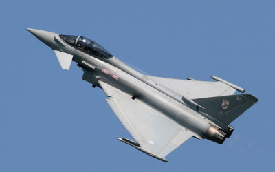
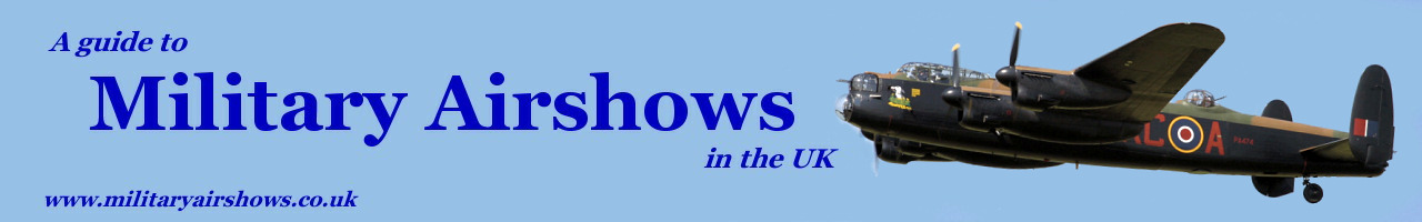
RAF Coningsby is located south-east of Lincoln in Lincolnshire, and is home to the southern Typhoon Main Operating Base (MOB), with two front line, combat ready Squadrons (3 Sqn & 11 Sqn). It is also home to a joint RAF/Qatari Air Force Squadron (12 Sqn) as well as a Typhoon Operational Conversion Unit (OCU) Squadron (29 Sqn) and a Typhoon Test & Evaluation Squadron (41 Sqn).
RAF Coningsby in Lincolnshire is one of two RAF Quick Reaction Alert (QRA) Stations which protect UK airspace. RAF Lossiemouth is the other.
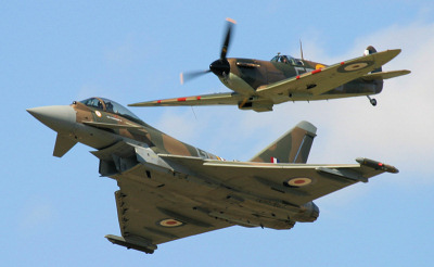
The Battle of Britain Memorial Flight is also based at RAF Coningsby with their Lancaster, Spitfires, Hurricanes, Dakota, and Chipmunk aircraft which perform at many airshows and events up and down the country.
Approach - 234.675, *362.300, 255.950, 119.200, *122.100 Radar (Director) - 379.950 PAR - 234.575, 276.775, *123.300 Tower - 124.675, 298.975, *122.100 Ground - 357.125, *121.850 OPS - 379.350 ATIS - 278.800 *= NATO Common Frequency |
| Add Your Photographs |
RAF Typhoon.
 RAF Typhoon & BBMF Spitfire.
 BBMF Lancaster.
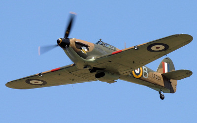 BBMF Hurricane.